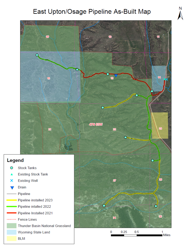
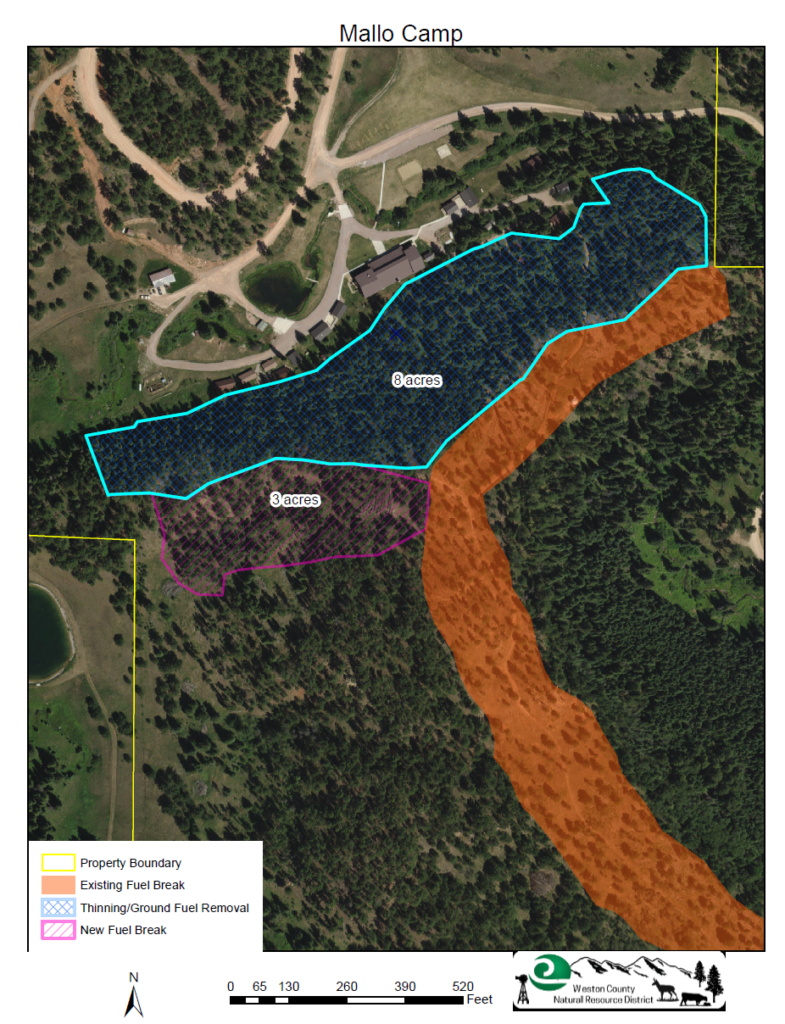
WCNRD offers GIS mapping services. This service is available for free or at a reduced cost for district members. GIS maps like the ones below are typically provided free of charge for WCNRD projects. Mapping services for non-district purposes may be provided, depending on the discretion and availability of district staff. There may be a fee for large or time-intensive maps and large-format prints.